«Uncover the World with High Resolution Satellite Imagery»

«Leading the Way in Geospatial Data Solutions»

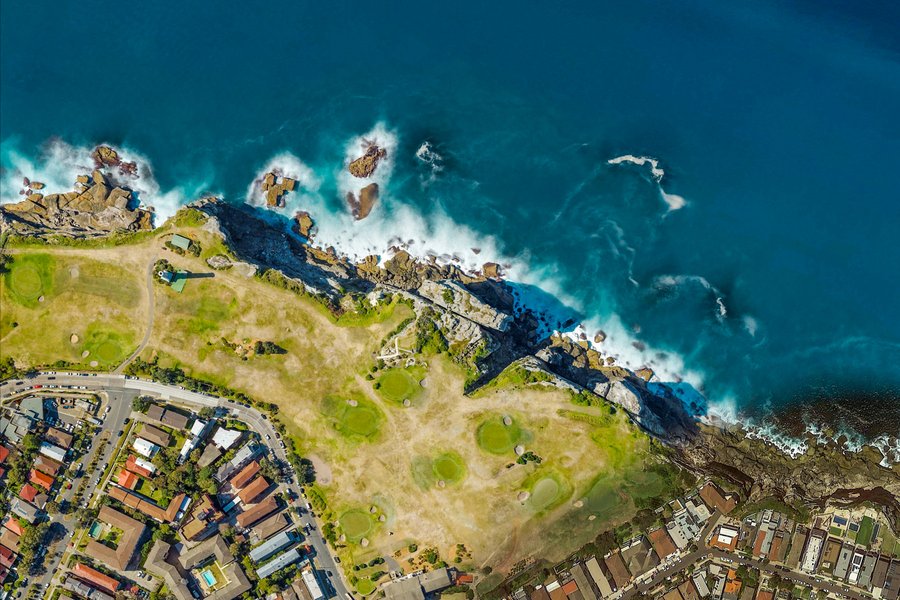
«The most convenient solution for purchasing satellite imagery»

«Optimal product for resolving issues»

«Always here for you, 24/7»

Dubai Silicon Oasis, DDP, Building A2, Dubai, United Arab Emirates

info@caspatial.space

ABOUT OUR DIRECTION

CAST INTERNATIONAL FZCO is a company that specializes in providing high-quality satellite images and data for various applications. They use advanced satellite technology to capture precise and detailed images of the Earth's surface. These images are then processed and analyzed to extract valuable information for industries such as mining, oil and gas, engineering, and environmental monitoring. CAST INTERNATIONAL's innovative solutions help clients make informed decisions by providing up-to-date and accurate geospatial information.

2018

Founded in

3+

Worldwide Sales & Customer Support

150+

Satisfied Customers

550+

Done projects

65+

Engineers

15+

Grands

Services

SATELLITES

Worldview 3 Satellite

WorldView-1 is equipped with the state-of-the-art control moment gyros (CMGs), which provide stunning agility, rapid retargeting and efficient in-track stereo collection.

Launch

2014

Altitude

617km

Sensor Bands: Panchromatic and 8-band multispectral (coastal blue, blue, green, yellow, red, red-edge, Near-IR 1, Near-IR 2) and Shortwave Infrared (SWIR)

Resolution: 0.31 meters GSD at nadir panchromatic, 1.24 meters GSD at nadir multispectral, and 3.70 meters GSD at nadir SWIR

Collection Capability: Up to 680,000 square kilometers of imagery per day

Worldview 2 Satellite

WorldView-1 is equipped with the state-of-the-art control moment gyros (CMGs), which provide stunning agility, rapid retargeting and efficient in-track stereo collection.

Launch

2009

Altitude

770km

Sensor Bands: Panchromatic and 8-band multispectral (coastal blue, blue, green, yellow, red, red-edge, Near-IR 1, Near-IR 2)

Resolution: 0.46 meters GSD at nadir panchromatic and 1.85 meters GSD at nadir multispectral

Collection Capability: 1,000,000 square kilometers of imagery per day

Worldview 1 Satellite

WorldView-1 is equipped with the state-of-the-art control moment gyros (CMGs), which provide stunning agility, rapid retargeting and efficient in-track stereo collection.

Launch

2007

Altitude

496km

Sensor Bands: Panchromatic

Resolution: 0.5 meters GSD at nadir

Collection Capability: 1,000,000 square kilometers of imagery per day

GeoEye Satellite

GeoEye-1 is able to revisit any point on Earth once every three days or sooner.

Launch

2008

Altitude

681km

Sensor Bands: Panchromatic and 4-band multispectral (blue, green, red, Near-IR)

Resolution: 0.41 meters GSD at nadir panchromatic 1.65 meters GSD at nadir multispectral

Collection Capability: 700,000 square kilometers of panchromatic (and up to 350,000 square kilometres of multispectral) imagery per day

PARTNERS

NEWS

Contacts

Dubai Silicon Oasis, DDP, Building A2, Dubai, United Arab Emirates

Feedback form