Thematic data analysis

Home /

Thematic data analysis

Thematic data analysis is the acquisition of information to solve narrowly focused issues. On the Basis of radar data, practical solutions are created that are used in rural and forestry, oil and gas industry enterprises, and environmental organizations.

Description

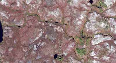
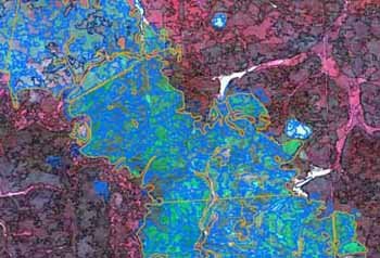
Description of space images includes two stages: preliminary and main. At the preliminary stage, remote data is preprocessed, which includes the creation of images in various color synthesis options, adjustment of the histogram for different types of objects, transformation of raster files into a given coordinate system, as well as the creation of mosaic coverings. During the main stage, images are directly decrypted using visual and automatic methods.

Thematic mapping

Thematic mapping as one of the areas of geographical mapping is aimed at identifying the patterns of spatial distribution of attributive (thematic) features of objects. When drawing up various maps, maps, cartograms, not a metric, but a topological model of the territory (neighborhood, articulation, shape, nature of the distribution of taxa by gradations of the thematic feature) is used.

Analysis

The results of decoding (vector layers, thematic maps) can be the basis for obtaining derivative types of information about the objects under study using methods of geoinformation analysis. Geoinformation analysis in general is an analysis of the location, structure, interrelations of objects and phenomena through spatial analysis and geomodeling. The main tools for such analysis are algorithms of geoinformation systems (for example, ArcGIS) - determination of buffer zones, density, intersection zones, assessment of transport accessibility, etc.

Contacts

Dubai Silicon Oasis, DDP, Building A2, Dubai, United Arab Emirates

Feedback form