OPTICAL IMAGERY
Highest resolution
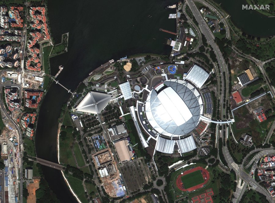
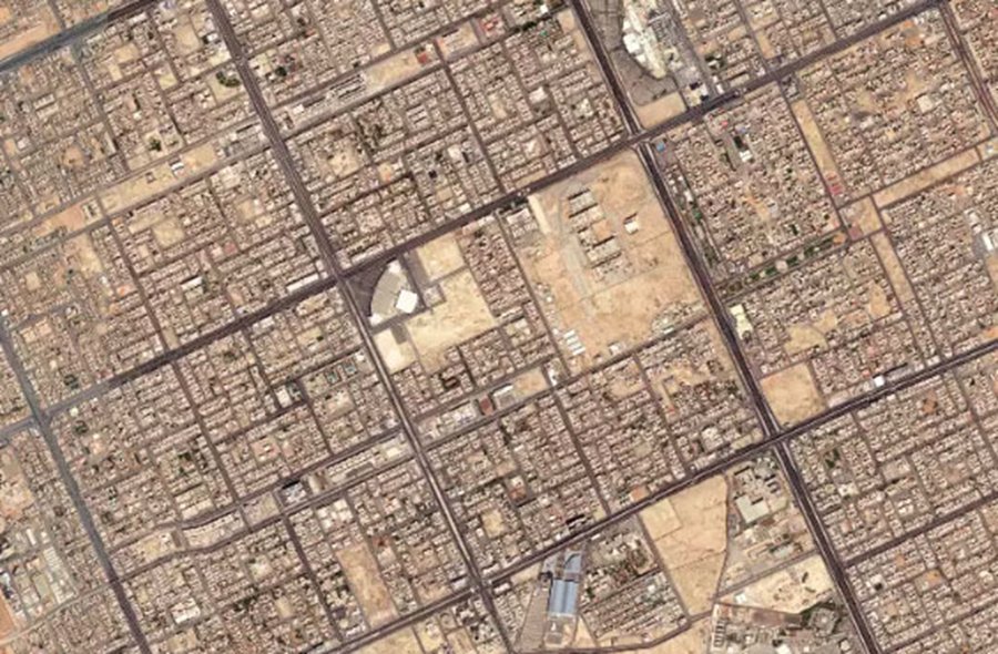
Maxar is the first company to deliver native 30 cm resolution and derived 15 cm high-definition imagery, delivering clearer, richer images that empower better decision-making through improved situational awareness.
Monitoring (ERS Data)
Monitoring is a system for monitoring processes, assessing the situation in the environment and society. In the process, an assessment of a phenomenon, an event is given, depending on the impact of numerous factors. Elements of the monitoring system
1. Monitoring the effectiveness of the intervention.
2. Observation of changes by sectors of human activity and the environment as a whole.
3. Analysis and integration of monitoring results.
For the monitoring process, people came up with a remote sensing process. Remote sensing is the process of detecting and monitoring the physical characteristics of the terrain, objects on it by measuring its reflected and emitted radiation at a distance (usually from a satellite or aircraft, UAV). Special sensor cameras collect remote sensing images in a wide electromagnetic spectrum range, with overview and detailed characteristics, in a time series that help researchers analyze the situation on Earth.
Maxar is the first company to deliver native 30 cm resolution and derived 15 cm high-definition imagery, delivering clearer, richer images that empower better decision-making through improved situational awareness.
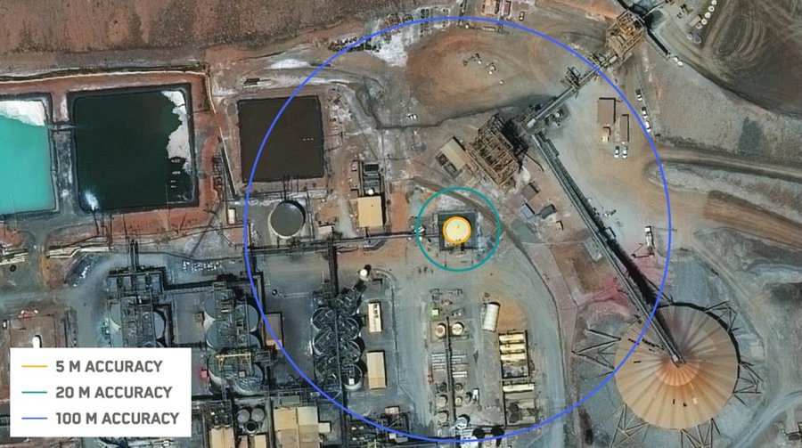
Our advanced accuracy technology ensures content from Maxar is as closely aligned as possible to a known coordinate on Earth. The average positional accuracy of our imagery is less than 5m CE90.
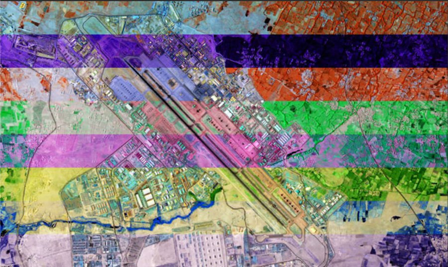
Go beyond what’s visible to the naked eye with multispectral imagery, including short-wave infrared (SWIR). Classify vegetation health, categorize man-made and natural material, penetrate smoke, detect fire, map minerals and more
Monitor borders, remote assets and the urban landscape, or plan future development projects.
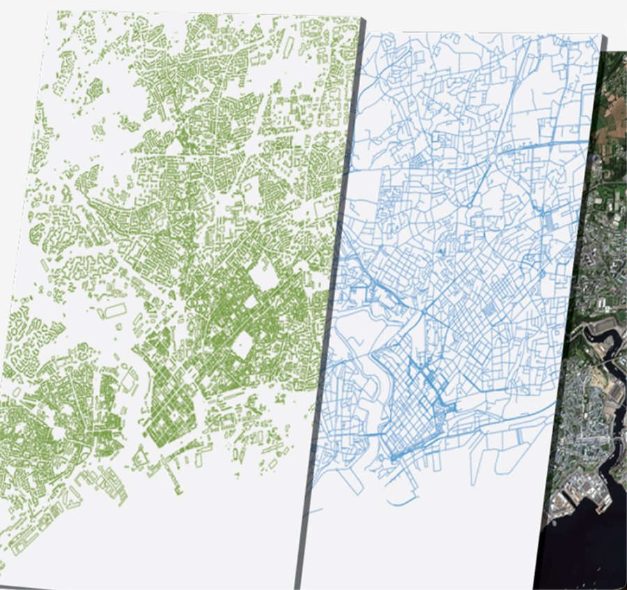
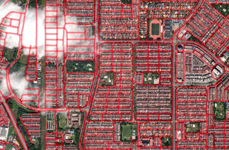
Extract roads, buildings and parcels, identify land use, and track change at local to global scale.
Produce 2D and 3D maps with a consistent, high-quality foundational image layer worldwide.
Provide a visual reference in applications or context to maps with a basemap that reflects reality.
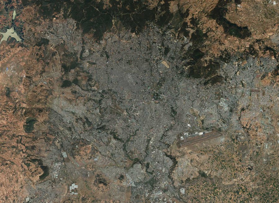
Vivid™ offers a suite of off-the-shelf imagery basemaps with up to 30 cm resolution and 5 m CE90 spatial accuracy. Vivid™ products are produced annually with the most current, clear imagery available. With high-quality image layers available immediately around the globe, Vivid™ is ideal for visualization, large area feature extraction, and providing context in maps and applications.
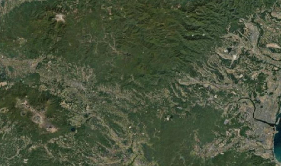
Dynamic offers the flexibility to configure or fully customize basemap parameters to meet specific project requirements. Dynamic basemaps are produced at the time of order for the requested areas, with rapid processing ensuring delivery within weeks. Dynamic builds can also be scheduled quarterly, semiannually or annually to align with project or business needs.
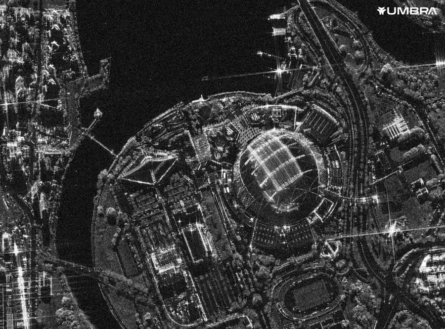
Through a strategic constellation access agreement with Umbra, Maxar has dedicated capacity from satellites in Umbra’s synthetic aperture radar (SAR) imagery constellation, enabling Maxar® to directly integrate those images into Maxar’s portfolio of Earth Intelligence products. This combined offering represents the most advanced multisource geospatial intelligence solution for a wide range of defense, intelligence and commercial applications. Through this offering, customers can make critical decisions based on real-time insights from the highest resolution electro-optical and SAR data in the industry. Customers have access to ultra-high resolution (down to 25cm) SAR satellite imagery from Umbra. Maxar also leverages decades of SAR processing expertise and its 3D datasets to enhance processing of the SAR imagery, delivering even more actionable insights.
Skip straight to analysis with Maxar’s analysis-ready data (ARD). ARD is preprocessed time-series stacks of imagery that are aligned and produced at a set standard. Aligned image stacks from ARD provide increased usable content via localized metadata, more accurate feature extraction, faster processing, lower storage costs and homogenized inputs for analytic workflows.
ARD puts the user in control. Customize your imagery selection, order only what you need and deliver imagery directly to your cloud environment. Accessing Maxar’s highest quality satellite imagery in analysis-ready format is easy with an API.
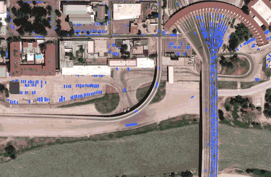
Use machine learning and artificial intelligence to extract roads, parcels and buildings as well as identify land use and vegetation at scale.
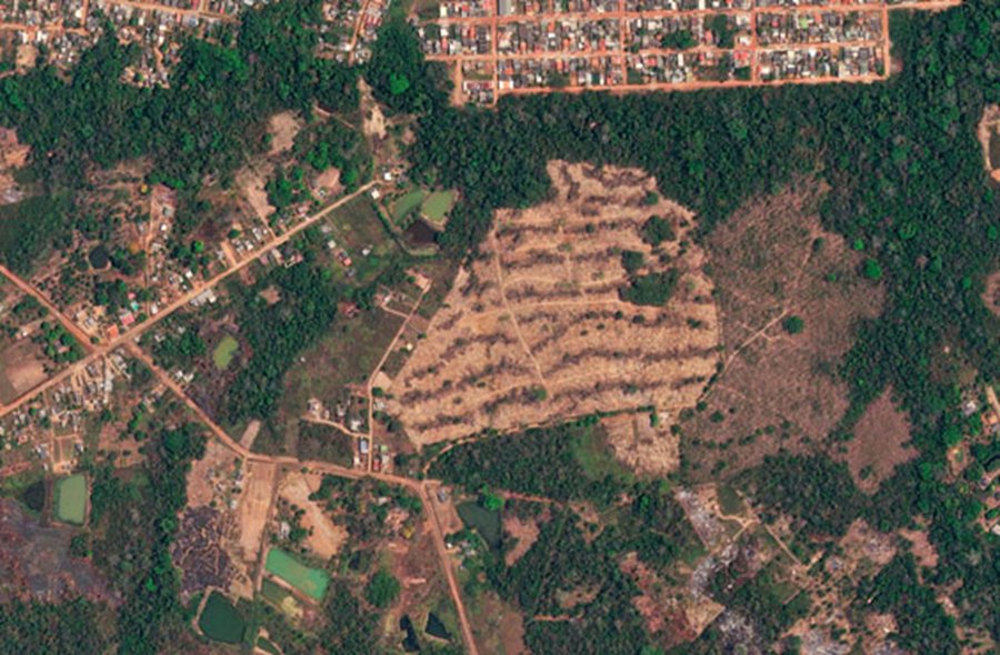
Create a localized detection model and deploy it as new imagery is collected to determine changes in your AOI.
Accelerate your change detection workflows with aligned and consistent time-series imagery.
Dubai Silicon Oasis, DDP, Building A2, Dubai, United Arab Emirates