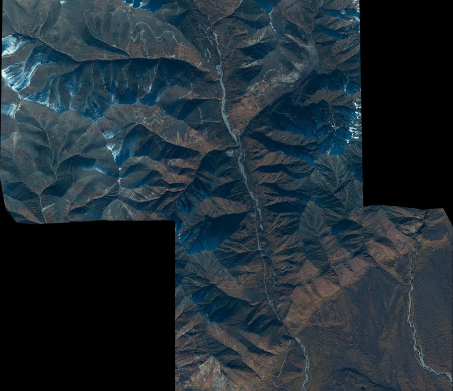
Photogrammetric Processing

Home /

Photogrammetric Processing

Photogrammetry is a scientific and technical discipline that deals with the size, shape and spatial position of objects from their photographic images. In literal translation, photogrammetry is measurements by light recording, i.e. by photo image (photographs). Photogrammetric works - in the classical sense, it is a process of establishing a mathematical dependence between the coordinates of objects and their images obtained by various shooting systems (photographic, television, radar, optoelectronic, etc.), as well as the study of the features of processing the corresponding images on the basis of classical methods of photogrammetry.

Orthophotoplan

Orthophotoplan (OFP) is a photographic image of the terrain in an orthogonal projection, given coordinate system and the required scale, obtained by orthotransforming images using CMR, reference points or RPS coefficients to eliminate distortions caused by shooting conditions, survey equipment, image angles and terrain, followed by stitching transformed images and cutting orthophotoplans on nomenclature or arbitrary sheets.

Orthomosaic

Orthomosaic (seamless image) is the result of combining ("stitching") several orthotransformed images (sniques) into one continuous balanced image with predetermined measuring and visual characteristics. Creation of orthophotomosaics (orthomosaics) - alignment of the brightness and tonality of several orthotransformed images and their subsequent "stitching" into a single orthophoto plan covering a large area, with the elimination of mutual distortions along the connection (sewing) lines of images.

The Digital Elevation Model (DEM)

The Digital Elevation Model (DEM) is a three-dimensional representation of the earth's surface, represented as an array of points with a determined height. The digital relief model (DMR) contains information about the height of only the true terrain, without taking into account vegetation, buildings and other anthropogenic objects. Digital relief models (DMR) are a type of three-dimensional mathematical models containing information about the elevations of the earth's surface. Unlike DMR, Digital Surface Models (DMP) describe all irregularities on the earth's surface, including vegetation and anthropogenic objects.

Digital terrain model (DMM)

Digital terrain model (DMM) is a cartographic model that includes a logical and mathematical description of terrain objects in digital form and contains data on their characteristics. The SMM is formed in the projections, schedule, coordinate systems and heights adopted for maps, taking into account the laws of cartographic generalization and the establishment of the necessary topological relations between objects. Digital terrain model (DMM) is a digital cartographic model containing data on terrain objects and its characteristics. The digital terrain model should be built so that independent models can be isolated from it in the symbols adopted for topographic plans: • the terrain; • communications; • buildings and structures; • hydrography; • soil and vegetation cover.

3D Modeling

The main data sources for creating DSM and 3D modeling are: • topographic map - provides coordinate and high-altitude information about such terrain objects as terrain, buildings and structures, roads, rivers, land use contours, administrative boundaries, etc. • remote sensing materials obtained in stereo mode are used to create DSM and orthophotoplans. • a cloud of points obtained by laser scanning. Orthophoto and topographic map are used to obtain the contour of buildings. Ground photos of each individual building from several points of view are necessary to build a photorealistic 3D model of buildings.

Contacts

Dubai Silicon Oasis, DDP, Building A2, Dubai, United Arab Emirates

Feedback form